
Overview
Experience a high-octane adventure descending from the majestic Chachani volcano. This tour is designed for adrenaline seekers who want to witness the snow-capped peaks of Arequipa while enjoying a massive 2,350-meter vertical drop.
- Scenery: Ride through the Salinas and Aguada Blanca National Reserve.
- Technical Descent: A 45 km route starting from high-altitude antennas down to the city’s outskirts.
- Adrenaline: 70% of the path is narrow mountain trail, perfect for experienced riders.
- Imposing Views: Splendid Andean landscapes and high-altitude volcanoes.
Full Itinerary
The journey begins with a departure between 8:00 and 8:30 a.m. for a day filled with speed and breathtaking views.
The Ascent:
We start with a 2.5-hour drive in our specialized transport, climbing to the starting point located at the antennas of **Nevado Chachani**. At 4,750 meters above sea level, you will be at one of the highest biking starting points in the region, surrounded by an intact Andean landscape.
The Descent:
After a safety briefing and gear check, the 45 km descent begins. For approximately 3 to 4 hours, you will experience the rush of descending magnitude. The route is a mix of 70% narrow mountain paths (trail) and 30% asphalt as we approach the city. You can coordinate stops with the guide to catch your breath and capture photos of the imposing snow-covered volcanoes.
Arrival:
The tour ends at the **Carmen Alto Lookout**, a beautiful spot just 10 minutes from Arequipa’s city center, where you can enjoy a final panoramic view of the valley.
Inclusions & Exclusions
The tour includes:
- Professional Tour Guide.
- High-quality Mountain Bike.
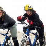
- Safety equipment: Helmet, gloves, knee pads, and elbow pads.
- Private transportation to the high starting point.
- Tool Kit for the route.
- Basic First-Aid kit.
The tour does not include:
- Personal insurance.
- Snacks and water.
- Tips for the crew.
Recommendations
Due to the high altitude and speed of the descent, we recommend taking:
- Warm Clothing: A jacket and sweater are essential for the cold at 4,750m.
- Pants: Long pants are mandatory for safety during the ride.
- Sun Protection: High-factor sunblock and sunglasses.
- Backpack: A small pack for personal items, water, and snacks.
Technical Data
| Max Altitude: | 4,750 m.s.n.m. |
| Min Altitude: | 2,400 m.s.n.m. |
| Total Distance: | 45 km. |
| Terrain Mix: | 70% narrow path / 30% asphalt. |
| Descent Time: | 3 to 4 hours approx. |
IMPORTANT: Participants must have a good command of the bicycle and regular physical resistance.
Frequently Asked Questions (FAQs)
Do I need to be a professional biker?
While you don’t need to be a professional, a **good command of the bicycle** is required because the descent involves narrow paths and high speeds.
How cold is it at the top?
It is very cold! You start at nearly 5,000 meters, so even on sunny days, the wind and altitude require a good jacket. As you descend, the temperature will rise significantly.
Can we stop to take pictures?
Yes! Even though it is a downhill tour, you can coordinate stops with your guide to appreciate the Salinas and Aguada Blanca National Reserve.